Rio Laja Trail UPDATE PROJECT
Volunteer to help us update the Rio Laja Trail guide!

RIO LAJA TRAIL
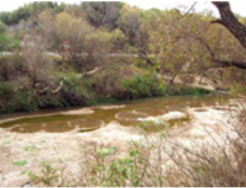
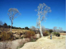
The Rio Laja Trail is a walking and biking trail following the banks of the Rio Laja in San Miguel de Allende from the Presa Ignacio Allende to approximately Dolores Hidalgo; spanning 32.43 miles (51.9 kilometers). The trail is based upon foot paths that have been established by rural residents over many years.
Ten years ago community volunteers mapped and documented the trail and important waypoints to promote:
- recreational use of the trail system for exercise, viewing birds and wildlife and enjoying the quiet and beauty of nature.
- awareness of the importance of the Rio Laja as a water resource in the San Miguel municipality and the need to protect and restore this fragile waterway.
Check out the links below to learn about each section of the trail.
volunteer to update the rio laja trail guide!
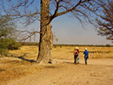
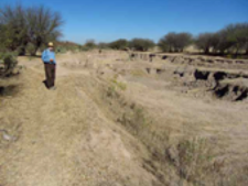
We are seeking dedicated volunteers to work in teams to document current conditions along the trail and the factors affecting the ecology of the river system, including the infestation of Lirio Acuatico (Water Hyacinth).
The information we collect will be used to update the Rio Laja Trail guide and to identify opportunities for trail and ecological improvements.
What to expect: Trail mapping requires teamwork and everyone’s full attention to the task. You are not required to participate in all 12 outings, but we hope that you will join us as often as you can.

RIO LAJA TRAIL GUIDE UPDATE PROJECT – KICK-OFF
SUNDAY, OCTOBER 8, 2023 SECTION 1
ABANDONED HACIENDA TRAIL
4.3 MILES/7 KILOMETERS (round trip)
8 am – 1 pm
Meet up at Bodega Aurrera parking lot for carpool at 8 am
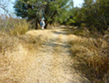
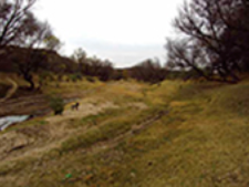
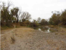
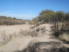
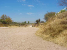
Section 1 of the Rio Laja trail is an easy walk, starting near the Otomi development and Amigos de la Presa boathouse. It’s also one of the shortest trails, which provides ample time for everyone to learn the ins and outs of trail mapping and documentation.
Gear up: Sturdy shoes (preferably hiking boots), layered clothing, hat, sunglasses, sunscreen, insect repellent, phone or camera for taking photos.
Fuel up: We’ll stop for a lunch break, so bring a lunch and water.
SIGN UP TO PARTICIPATE!
Send us an email and let us know if you want to participate in the October 8th outing or future outings and if you can provide transportation. Include your full name and telephone number.
Rio Laja Trail Printable Trail Guides
Section 1: Abandoned Hacienda Trail
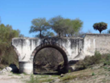
Section 2: Puente Antiguo San Rafael
Section 3: Xote Trail
Section 4: Santuario Trail
Section 5: Monasterio Nuestra Señora de la Soledad
Section 6: Yellow and Purple House Trail
Section 7: La Petaca Bridge Trail
Section 8: Capilla de San Judas Tadeo
Section 9: White Pillar Trail
Section 10: KM 79 Trail
Section 11: Blue House Trail
Section 12: San Luis de la Paz Bridge
Rio Laja Trail Printable Trail Guides and AllTrails Links
Section 1: Abandoned Hacienda Trail
Section 1: Abandonded Hacienda Trail
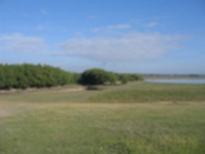
Trailhead: Road to Otomi. Total miles: 2.17 (3.49 km) Bike friendly, easy intermediate. May be flooded during the high water season.
Section 3: Xote Trail
Section 3: Xote Trail
Section 4: Santuario Trail
Section 4: Santuario Trail
Trailhead: Casa de Aves Bridge Total miles: 3.55 (5.71 km) Bike friendly.
Section 5: Monasterio Nuestra Señora de la Soledad
Section 5: Monasterio Nuestra Señora de la Soledad
Trailhead: San Miguelito Total miles: 2.64 (4.25 km) Bike friendly, intermediate.
Section 6: Yellow and Purple House Trail
Section 6: Yellow and Purple House Trail
Trailhead: Monasterio Total miles: 2.24 (3.60 km) Bike friendly, easy intermediate.
Section 8: Capilla de San Judas Tadeo
Section 8: Capilla de San Judas Tadeo
Trailhead: Casa de Aves Bridge Total miles: 3.55 (5.71 km)
Section 9: White Pillar Trail
Section 9: White Pillar Trail
Trailhead: Pueblito Capilla de San Judas Tadeo Total miles: 3.25 (5.23 km)
Section 10: KM 79 Trail
Section 10: KM 79 Trail
Section 11: Blue House Trail
Section 11: Blue House Trail
Trailhead: KM 79 Marker Total miles: 3.1 (4.99 km) Bike friendly, intermediate.
Section 12: San Luis de la Paz Bridge
Section 12: San Luis de la Paz Bridge
Trailhead: Rioyos soccer field Total miles: 2.09 (3.36 km) Bike friendly, intermediate.
Subscribe to our newsletter
Our monthly newsletter will keep you up to date on our scheduled events, our work, and features monthly nature-related articles.